Updated Tuesday 9-11-2012
Hike is just east of Stevens Pass.
View of Minotaur and Labyrinth Mountain in background
Green Trails Maps- One of the 10 essentials
Check out Green Trails Maps for directions. Map for this week's trip is 144 . Click link below for complete list of maps.http://
http://greentrailsmaps.com/maps/index_Map_wa/
Photo below is on trail the way up
Photo below is view of the lake
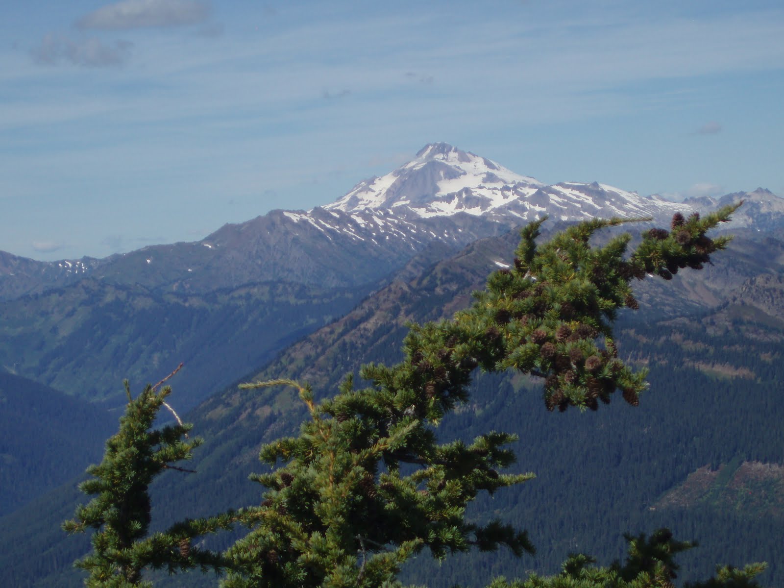
Photo below is view from the top of Labyrinth Mountain of Glacier Peak
Photo below is view from the top of Labyrinth Mountain of Minotaur Lake
Driving directions: From Everett head east on US 2 for 65 miles to Stevens Pass. Continue east for another 4 miles. onto Smith Brook Road (Forest Road 6700). (From Leavenworth reach the turnoff in 30 miles.) Follow FR 6700 and go past Smithbrook trailhead and then past Nason Ridge Trailhead. At about 4 3/4 miles from Stevens there is a sharp left fork and take this and this is still FS 6700. Than at 6.8 miles from Stevens Pass turn left onto FR 6704. Proceed for 0.9 mile to the road's end and trailhead (elev. 3800 ft).
Trail stats: To lake only 1.60 miles and 1750 feet. That is steep!!! But worth it. Lake at 5500 feet. Top or Labyrinth is at 6376 a scramble.
Bring map,compass and GPS as the directions are the best estimates that we have


No comments:
Post a Comment