The early forecast for the 2010-11 winter for the Northwest was a strong La Nina in place and that usually means above average precipitation and below average temperatures for the Northwest. La Nina is below average sea surface temperatures off the equatorial coast of South America. That usually translates into a good snowpack for the Northwest. However that has not been the case so far.
In many areas of Western Washington during December of 2010 there was above average precipitation and above average temperatures with a heavy rain event with very high freezing levels (what can be usually called a pineapple express). In January we had a similar situation in which there were above average temperatures and average precipitation and another pineapple express.
Given the above weather patterns it is not a surprise that the current snowpack (on the ground) as of 2-4-2011 is at about 60% to 70% of normal for the Central Cascades. The big question is why has this occurred.
What Happened to the Snow
One of the major weather features that has caused this below average snowpack is that we have had an upper level ridge of high pressure that has been over the West Coast for much of the last month (see 500 mb map below which is map from 2-1-2011). 500 mb map is at 18,000 foot level.
This ridge of high pressure has kept the cold air in the Midwest and East Coast for much of the time for those regions and of course they have had several major snow storms this winter.
Will the Snow Return?
What needs to happen for the snow to return to the mountains is that this upper level ridge of high pressure will need to retrograde or move to the west. Sure enough many of the extended forecast models are indicating that. The Climate Predication Center forecast (500 mb map below)for the period February 12 to February 18 indicates that a trough of low pressure is over the Northwest and the upper ridge of high pressure has indeed retrograded to the west. This type of pattern usually brings below normal temperatures and above normal precipitation thus a good pattern for mountain snow.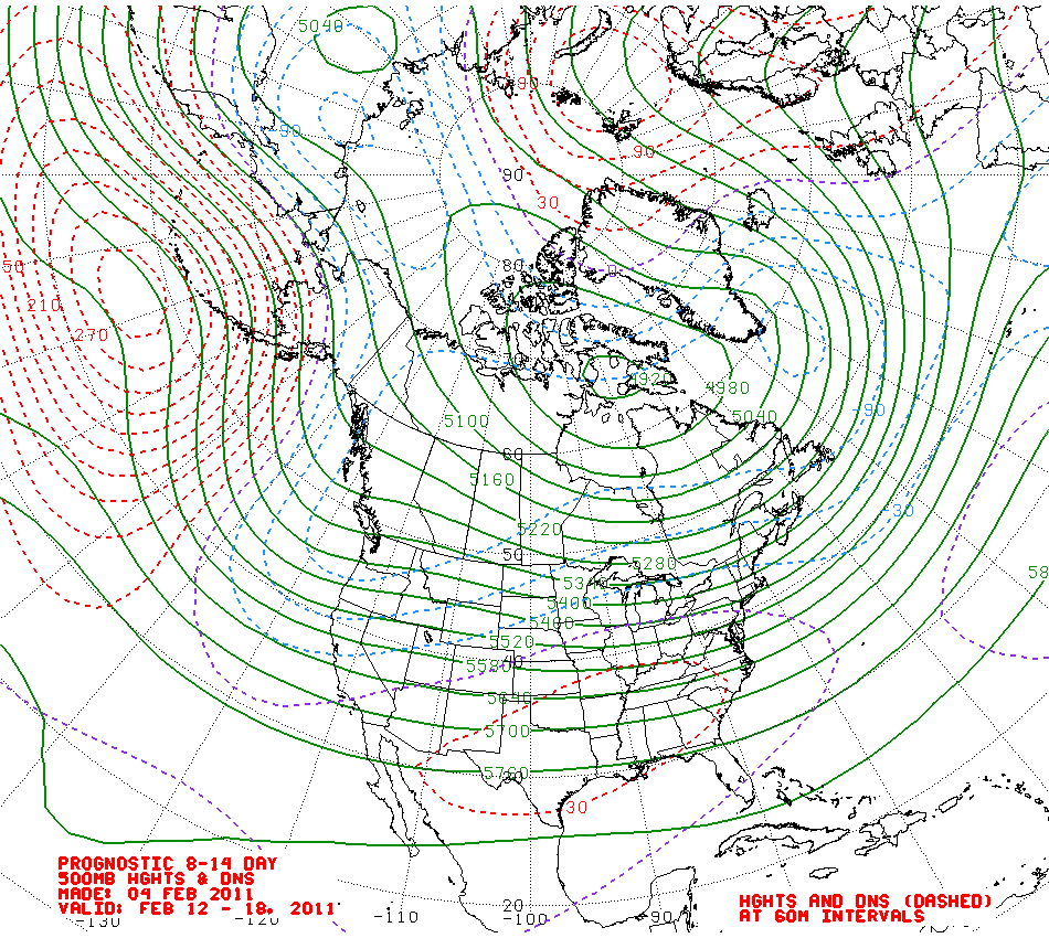
The European forecast models concur with the US one (Climate Prediction Center) as the 500 mb map below also brings the trough of low pressure over the Northwest for what should be a cooler and wetter pattern.
Summary
Near February 15 the forecast models are indicating a change in the weather patterns that should bring additional snowfall to the Cascades. The big question is how long will this cool and wet pattern remain. It would seem to be in place for at least a week after February 15. However the bigger unanswered question is what the patterns will be as we move into March. One would think with La Nina still in place that a cool and wet pattern will be the rule but we will have to see.
No comments:
Post a Comment