Wednesday, January 25, 2012

Weather Northwest February 2012

Issued: 1-25-2012
Some of the forecast models are suggesting that the Northwest gets an upper level ridge of high pressure that builds at times over the next 10 days. The 500 mb map below (18,000 foot level) confirms that. If this pattern verifies the Washington Cascades can be looking at average to below average precipitation starting this Friday 1-27-2012 through 2-4-2012. However just lower to medium confidence in this forecast.

Wednesday, January 18, 2012

Weather Forecast Washington Cascades

Issued 1-18-2012
Extended forecast keeps the cool and wet pattern in place for the Washington Cascades. So above average snowfall will be the theme. The map below (500 mb at 18,000 feet) shows a trough of low pressure off the Washington Coast and this will keep the cool and wet pattern in place through January 27, 2012

Wednesday, January 11, 2012

KUOW- Hike or Snowshoe trip of the week

Updated 1-11-2012
Tonga Ridge west of Stevens Pass near town of Skykomish. Since we have not had much new snow lately this will probably be hard packed so a snowshoe trip of this might be the best. However starting this Sunday (1-15-2012) and or early next week we should have some new mountain snow. How about lowland snow???
Photo below is conditions at lower part of the road, hard packed, photo by Michael Fagin
Photo below is one of the views you start to get looking towards north and west, photo by Michael Fagin
Photo below another view looking towards the north and west, photo by Michael Fagin

Photo below is of happy hiker-snowshoer, photo by Michael Fagin
Photo below near end of our trip at dusk, photo by Michael Fagin

Driving Directions: Drive east on U.S. Highway 2 toward Stevens Pass. After passing the Skykomish Ranger Station on the left, continue another 0.5 mile and turn right (south) onto Foss River Road (Forest Road 68). Follow this road 3 miles to the junction with FR 6830, and turn left (east) onto FR 6830. Drive up as far on this road as you are comfortable and then find a spot on the side of the road to park. All wheel drive vehicle would be the best to have.
Trail Stats: Tricky as just depends where you park. Could be as low as 2000 feet. Enjoy trip be safe with your judgement of where to park.
Please bring map and compass and or GPS as trail and directions are the best estimates.

Thursday, January 5, 2012

KUOW Hike of the week

Updated 1-5-2012
Saturday should be dry with chance of showers on Sunday. So Friday 1-6 and Saturday 1-7 best chance of dry conditions and views.
Tiger Mt (West Tiger 3) is just east of Issaquah is snowfree now and a good workout. Maybe and I mean maybe a dusting of new snow at the top
Photo below is view of Cascades just below the summit, photo by Michael Fagin
Photo below is view of clouds just below the summit, photo by Nick Eckstein
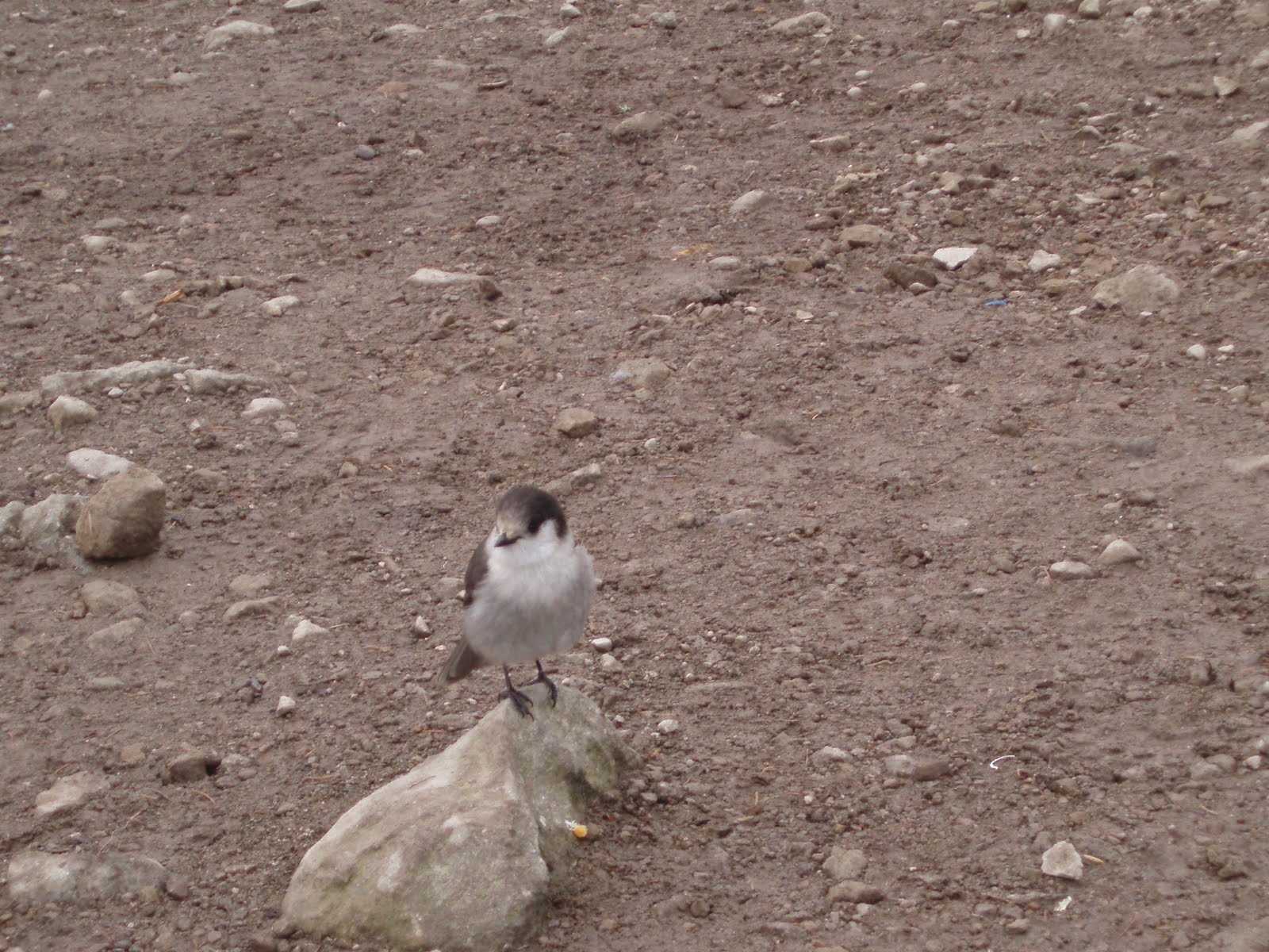
Photo below is some of the wildlife found at summit- Gray Jay, photo by Michael Fagin
Driving Directions: Take I-90 and get off at exit 20 (High Point exit). Then go west along road (parallels I-90) and follow it until you get to gravel road and then go a short distance until you get to trailhead.
Trail Stats: 5 miles round trip, 2100 feet gain, high point 2500 feet. Follow signs to West Tiger 3. Discovery Pass needed to park at trailhead.

Amabilis Mountain


Ski or snowshoe this. This is just about 10 miles east of Snoq Pass. Get there early or go there on Friday.
Photo below is skier going up hill, photo by Michael Fagin

Photo below is view from part way up the Mt, photo by Michael Fagin
Driving Directions: Exit 63 off of I-90, Cabin Creek exit.
Trail Stats: Go up FS 4822 which is 8 miles round trip, 2100 feet feet gain, high point is 4550 feet. Sno Park Pass needed to park here.
Driving directions and trail directions are the best estimates. Please bring map and compass and or GPS.

Wednesday, January 4, 2012

Weather forecast- Washington Cascades Extended

Issued 1-4-2012
Forecast models continue the pattern of bringing a ridge of high pressure into the region. The map below 500 mb (18,000 foot level) shows a ridge of high pressure over the Northwest for 1-13-2012. This type of pattern will tend to bring below normal mountain snowfall to the region will tend to be the theme.